Clear Sky Chart

Top Sponsors

Winer Observatory

All Sponsors
Be a Sponsor


Contents

Find a chart
News (April 5)
Meet the Perps
Coverage Map
Your own chart
Silly Files (Jan 5)
Boring Admin Stuff
 -Terms of Use
 -Copyright
 -Privacy
 -Advertising
Credits
How to Help
Contacts


Related Sites


International Dark-Sky Association
RASC Light Pollution Abatement

Clear Sky Alarm Clock


Asteroid
(161693) Attilladanko


WOW Favorite Link Award

Stellar Link Award - presented by astronomyLINKS

The Clear Sky Chart Home Page

What is it?

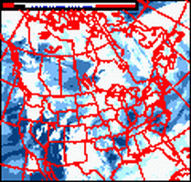
Created by Attilla Danko and maintained by CSCCharts, it's the astronomers forecast. It shows at a glance when, in the next 96 hours, we might expect clear and dark skies for one specific observing site. There are many, but the example above is for ().

It's is specifically intended for amateur astronomers. The data comes a forecast model developed by Allan Rahill of the Canadian Meteorological Center.

Read from left to right. Locate a column of blue blocks. That's when the sky will likely to be clear and dark. A more detailed explanation is here, but the short version is: the clear sky chart predicts hourly cloud cover, atmospheric transparency and seeing. (Good "seeing" occurs when the air is steady enough to allow you to see fine detail on planets through a telescope.) That means you can plan whether to observe galaxies or planets or stay home and process image data.

If you find this image, or the underlying forecast maps, useful please email Allan Rahill. He needs to show his bosses at CMC that his astronomy forecasts are actually being used. Feel free to copy me. If you find the charts very useful and want more frequent updates and more features use the chart pages more.


sponsored link: Email marketing for franchises.

Are there Charts for other locations?

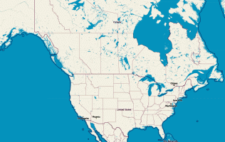
Yes, thousands. The coverage area is Canada, USA and parts of Mexico.
SearchBrowse
Search Nearby:

By Keyword
Ex: "lick observatory" finds the Mount Hamilton chart.

By Entered Position
dd.dd:Lat:NLong:W
Or
dd°mm':Lat:N°'Long:W°'
Display distance in:Kms Miles
Coverage Map

Clickable map
Charts on OSM Maps

All Charts

By popular keyword

Want a more powerful search, try:

Google
Web cleardarksky.com
Newest charts
All 6150 charts: in one page (1038Kb) for those who like to grep.
Canada
Alberta(152)listmap
British Columbia(147)listmap
Manitoba(51)listmap
New Brunswick(41)listmap
Newfoundland(24)listmap
Northwest Territories(7)listmap
Nova Scotia(68)listmap
Nunavut(8)listmap
Ontario(429)listmap
Prince Edward Island(14)listmap
Quebec(309)listmap
Saskatchewan(42)listmap
Yukon(17)listmap

1309 charts in Canada


Mexico
Baja California(7)listmap
Chihuahua(2)listmap
Sonora(7)listmap

16 charts in Mexico

Bahamas
Cat Island(1)listmap
Grand Bahama(1)listmap
New Providence(1)listmap

3 charts in Bahamas

USA
Alabama(58)listmap
Alaska(38)listmap
Arizona(175)listmap
Arkansas(50)listmap
California(465)listmap
Colorado(171)listmap
Connecticut(46)listmap
DC(3)listmap
Delaware(11)listmap
Florida(199)listmap
Georgia(106)listmap
Idaho(62)listmap
Illinois(119)listmap
Indiana(78)listmap
Iowa(44)listmap
Kansas(69)listmap
Kentucky(56)listmap
Louisiana(33)listmap
Maine(62)listmap
Maryland(58)listmap
Massachusetts(73)listmap
Michigan(156)listmap
Minnesota(82)listmap
Mississippi(36)listmap
Missouri(104)listmap
Montana(34)listmap
Nebraska(52)listmap
Nevada(56)listmap
New Hampshire(49)listmap
New Jersey(62)listmap
New Mexico(130)listmap
New York(190)listmap
North Carolina(128)listmap
North Dakota(13)listmap
Ohio(134)listmap
Oklahoma(63)listmap
Oregon(121)listmap
Pennsylvania(187)listmap
Rhode Island(17)listmap
South Carolina(105)listmap
South Dakota(40)listmap
Tennessee(88)listmap
Texas(390)listmap
Utah(90)listmap
Vermont(40)listmap
Virginia(146)listmap
Washington(140)listmap
West Virginia(39)listmap
Wisconsin(108)listmap
Wyoming(45)listmap

4821 charts in USA

May I get my own Chart?

If you observe at a site more than 24km or 15 miles from an existing chart site, feel free to request a chart for it. You can find the closest chart site to a latitude/longitude here.

I can generate charts for almost anywhere in Canada and US. See the coverage map.

To ask for a CSC, email CSCCharts (Attilla Danko or a colleague) with:

  • Latitude and longitude accurate to at least 0.001 degree in DD.DDD format. Also elevation, if you know it. Within 300m or 1000ft is good.

  • For towns, use heavens-above.com. For other sites, use Google Maps: zoom in on your site, then click on "link to this page" and email me the resulting url.
  • Timezone and whether you use daylight savings time during summer.
  • Province or State, so I can list it correctly in the directories.
  • Name, or what you'd like to see in the title. Like "Starhill Observatory" or "Saskatoon". Please choose the name of a place. But star party names are good too.
  • Whether the site is public or private, or has any affiliations with astronomy clubs or organizations.
  • The name of the closest chart to your new location and the distance. You can find the closest chart site to a latitude/longitude here
  • URL of a web page related to the site, if you have one. Club or observatory web pages, or web pages about public places at the location of the chart are welcome.
  • Check the privacy policy and let me know if you'd like to keep confidential your site's precise location.

I reserve the right to offer you a different chart that is still close enough to give maximally accurate forecasts.

There is no cost. But you're welcome to sponsor.


Clear Dark Sky Homepage

Copyright © 2025 Attilla Danko. Page updated 2025-01-17 02:04:56UT on server1.